Drone Mapping

Drones are the perfect solution for aerial mapping. Drones with high resolution cameras help in topographic surveys with highly accurate measurements, faster land surveying methods in difficult to access environments where human movement is a great challenge.
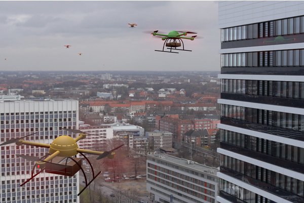
Drone Mapping in Land Surveying
Drone mapping is a modern surveying technique that uses UAVs (Unmanned Aerial Vehicles) to capture aerial data of land surfaces. At RVS Land Surveyors, we use high-resolution drones to produce orthomosaic images, elevation models, and 3D maps for faster and more accurate decision-making in projects across India.
Types of Drone Mapping Outputs We Provide
We offer multiple drone mapping deliverables, including:
- Orthomosaic images
- Digital Elevation Models (DEM)
- Digital Terrain Models (DTM)
- Contour maps
- 3D Point Clouds
These outputs help in site planning, volume calculation, and layout design.

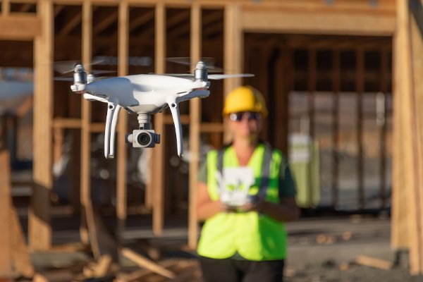
Topographic Survey with Drone Technology
Drones allow us to conduct topographic surveys with high precision, even in difficult terrains. Using RTK-enabled drones, we generate accurate elevation data and contour lines faster than traditional tools. This is ideal for large land parcels, highway projects, and plotting layouts.
Legal Compliance for Drone Mapping in India
Drone surveys in India must follow DGCA (Directorate General of Civil Aviation) regulations. RVS Land Surveyors uses drones that are registered and operated by certified pilots. We ensure all safety norms, permissions, and flying zone guidelines are followed strictly during every drone mission.

Drone Mapping
What is Drone Mapping in Land Surveying? | RVS Land Surveyors India
Discover how drone mapping revolutionizes land surveying with real-time data and aerial accuracy for projects across India.
- Introduction to drone technology in surveying
- How drones collect geospatial data
- Benefits over traditional survey methods
- Where drone mapping is commonly used
Benefits of Drone Mapping for Construction Projects
Drone Mapping Benefits for Construction Projects | RVS India
Learn how drone mapping boosts speed, accuracy, and safety in construction site surveys across India.
- Faster data collection compared to ground surveys
- Reduces manpower and improves safety
- High-resolution imagery for design accuracy
- Real-time progress monitoring
Drone Mapping vs Traditional Land Survey – Which is Better?
Drone Mapping vs Traditional Survey | Which One to Choose?
Compare drone mapping with traditional land surveying methods. Know the pros, cons, and ideal use cases for both.
- Comparison of accuracy, time, cost, and efficiency
- When drone mapping is ideal
- When total station or GNSS is better
- Hybrid approach used by RVS Land Surveyors
How Drone Mapping Works: Step-by-Step Process

How Drone Mapping Works in Land Surveying | Process Explained
Understand the full process of drone mapping from flight planning to 3D model generation.
- Flight planning with GPS waypoints
- Image capture and ground control points (GCPs)
- Data processing with photogrammetry software
- Output: Orthomosaic, 3D maps, elevation models
Industries That Benefit from Drone Mapping Services

Industries Using Drone Mapping in India | RVS Survey Services
Drone mapping supports various industries like real estate, infrastructure, mining, and agriculture. Explore its wide usage.
- Construction & Real Estate
- Highway & Bridge Projects
- Land Development & Plotting
- Mining & Quarry Monitoring
- Agriculture & Plantation Health Mapping
Types of Data Collected in Drone Mapping Surveys
Types of Data in Drone Mapping Surveys | RVS Land Surveyors
Get detailed insights into data collected by drones – from contour lines to 3D models and elevation points.
Drone mapping outputs, topographic drone survey, photogrammetry drone data.
- Orthomosaic images
- Digital elevation models (DEM)
- Digital terrain models (DTM)
- Contour maps and 3D point clouds
- Vegetation index (NDVI) for agriculture
Frequently Asked Questions - Boundary Surveys
What is drone mapping?
Drone mapping is the process of using unmanned aerial vehicles (UAVs) equipped with high-resolution cameras and GPS to capture aerial images, which are then processed into detailed maps and 3D models.
Drone mapping in Coimbatore | Aerial land survey using drones.
Why is drone mapping used in land surveys?
Drone mapping provides high-accuracy topographic data quickly and safely, especially for large or difficult terrains. It is commonly used for construction planning, agriculture, mining, real estate, and infrastructure projects.
Benefits of drone land survey in Tamil Nadu | Fast drone surveying in Coimbatore.
What are the advantages of drone mapping?
- Faster data collection
- High-resolution imagery
- Access to hard-to-reach areas
- Cost-effective
- Real-time monitoring
Advantages of drone mapping Coimbatore | Efficient land survey methods.
How accurate is drone mapping?
With advanced GPS and photogrammetry software, drone mapping can achieve centimeter-level accuracy. Accuracy depends on terrain, equipment, and surveyor expertise.


